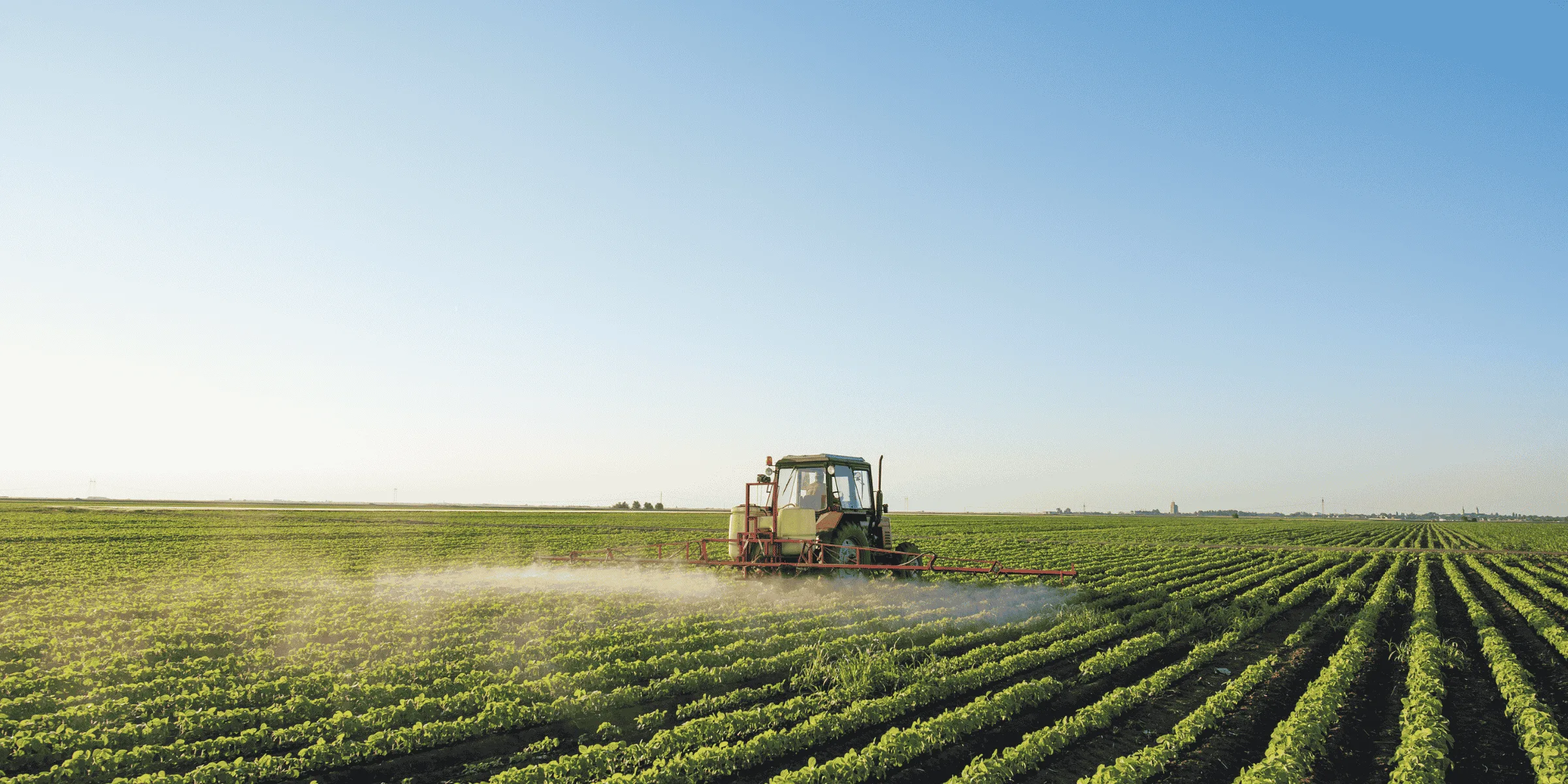
Applying the same amount of fertilizer, seed, or crop protection product across an entire field is simple. But fields are rarely uniform. Soil, crop growth, moisture, yield potential, and nutrient requirements can change from one area to another.
Variable rate application (VRA) turns those meaningful differences into a location-based application plan. Instead of one field receiving one fixed rate, defined zones can receive different rates based on field evidence and an agronomic decision.
This practical guide follows the complete workflow from field data to management zones, application rates, a prescription map, export, and machine execution.
What Is Variable Rate Application?
Variable rate application is a precision agriculture method that changes the amount of an input applied in different parts of a field. It replaces the simple model of one field → one rate with one field → multiple zones → different rates.
Depending on the operation and equipment, variable rate technology can be used for fertilizer, seed, lime, soil amendments, and certain crop protection workflows.
| Management zone | Example application rate |
|---|---|
| Zone A | 80 kg/ha |
| Zone B | 110 kg/ha |
| Zone C | 140 kg/ha |
These rates are examples only. Real rates should reflect soil or crop evidence, product recommendations and labels, field conditions, local regulations, and professional agronomic judgment. The defining idea is simply that the application rate changes according to location.
Why Use Variable Rate Application?
A field can look uniform from the road while behaving very differently inside. Variation may follow soil type, fertility, organic matter, elevation, drainage, crop vigor, historical yield, water availability, machinery traffic, or pest and disease pressure.
When those differences affect how an input should be applied, blanket treatment may not be the right plan. VRA provides a way to convert field variability into machine-readable instructions. The goal is not automatically to apply less; it is to apply an appropriate rate in an appropriate area using the best information available.
This matches the site-specific logic behind USDA NRCS nutrient management guidance, which emphasizes the right nutrient rate and place using soil tests, crop needs, and precision technology.
How Does Variable Rate Application Work?
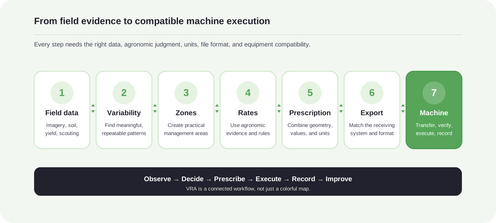
A typical map-based VRA workflow has seven connected steps. A problem in any one of them—weak data, meaningless zones, an unsuitable rate, the wrong file format, or incompatible equipment—can prevent the prescription from working as intended.
Step 1: Collect Field Data
Before two areas receive different rates, there should be a practical reason to manage them differently. The right evidence depends on the operation. Common sources include satellite imagery and NDVI, georeferenced soil samples, yield maps, drone imagery, existing field maps, and farm history.
Satellite imagery and NDVI
Satellite imagery can help reveal differences in crop development. NDVI and related vegetation indices are useful for locating stronger and weaker vegetation, but they do not automatically reveal the cause or the correct application rate.
NASA Earth Observatory explains that NDVI compares reflected visible and near-infrared light to indicate vegetation density. Cloud, surface, crop-stage, and canopy effects still make scouting and agronomic context important.

Soil, yield, drone, and existing field data
- Soil sampling: georeferenced nutrient levels, pH, organic matter, texture, and other properties can support spatial decisions.
- Yield maps: multiple seasons can help show whether performance patterns persist rather than appearing once.
- Drone imagery: higher-resolution images may help locate crop-vigor, population, or other field differences.
- Existing maps: field boundaries, management zones, Shapefiles, previous prescriptions, and application maps may be reusable.
Step 2: Identify Meaningful Field Variability
More data does not automatically produce a better prescription. The practical question is whether a visible or measured difference is meaningful enough to manage separately. Compare layers, look for repeatable patterns, and scout the field before assigning a cause.
"Digital maps can show where the field is different. They do not always explain why."
Step 3: Create Management Zones
Once variability is understood, divide the field into practical management zones. Zones may come from satellite imagery, soil analysis, yield data, drone imagery, historical knowledge, imported spatial data, or manual drawing.
More zones do not automatically make a prescription better. The number and shape of zones should fit the agronomic objective, the available evidence, and the resolution and control capability of the receiving equipment.

Step 4: Decide the Application Rate for Each Zone
This is the key agronomic decision. A map may show that Zone A and Zone B differ; it cannot always tell you that one should receive 80 kg/ha and the other 120 kg/ha.
Use relevant soil or plant tests, crop requirements, realistic yield targets, product-label directions, local rules, field scouting, historical performance, weather, and agronomist recommendations. Treat the prescription map as a decision-support and execution tool, not an automatic diagnosis.
Step 5: Create a Prescription Map
A prescription map combines geographic zones with their assigned values. In simple terms, it tells compatible machinery: apply this rate when the machine is inside this area.
- Zone A → 80 kg/ha
- Zone B → 110 kg/ha
- Zone C → 140 kg/ha
A prescription normally includes a field location or boundary, spatial zones, assigned values and units, and the machine-readable geometry needed by the receiving workflow. It is the bridge between field analysis and execution.

Try the workflow
Want to Create Your Own Prescription Map?
Turn field data into management zones and machine-ready prescriptions with FieldFusion.
Step 6: Export the Prescription Map
A prescription must reach the terminal, controller, or platform that will execute it. File and transfer requirements vary by tractor, implement, display, farm management platform, and equipment manufacturer. Confirm the receiving workflow before building the final export.
ISOXML vs Shapefile
Shapefile is a widely used GIS format that can carry field boundaries, polygons, points, zones, and attribute values. In a prescription workflow, the complete set of related Shapefile components must stay together.
ISOXML supports data exchange in compatible agricultural task-controller workflows. ISO 11783-10 defines task-controller and farm-management information-system data interchange, including formats used to communicate with farm-management computers and control functions.
The correct choice is the format the specific receiving system can read and execute. FieldFusion does not make every file suitable for every machine; compatibility must be confirmed for the actual tractor, terminal, controller, and implement combination.
Step 7: Send the Prescription to the Machine
Transfer may happen through USB storage, cloud synchronization, a farm or manufacturer platform, or a direct integration. During the operation, a compatible system links the machine's position to the current prescription zone and sends the assigned rate to the controller.
Variable Rate Fertilizer Application
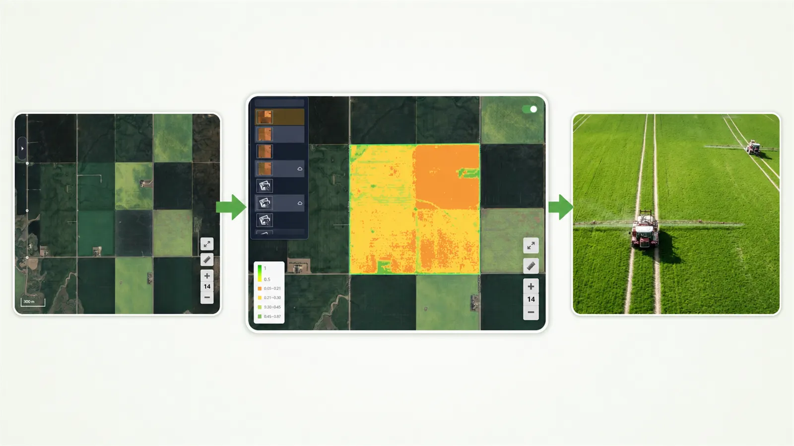
Fertilizer is one of the most common VRA uses because nutrient levels, soil properties, yield potential, and crop requirements can vary within a field. A fertilizer prescription can translate an approved nutrient plan into lower, standard, or higher spatial rates where appropriate.
Variable rate fertilizer application does not replace soil testing or nutrient planning, and it does not guarantee lower total fertilizer use. It provides a way to execute a site-specific plan using compatible variable rate equipment.
Variable Rate Spraying
Compatible spraying workflows may also vary instructions between field areas. The sequence remains field evidence → zones → approved rates → prescription → sprayer, but crop protection products can have strict label and legal requirements.
Follow the product label, permitted minimum and maximum rates, buffer and weather restrictions, local regulations, and agronomic recommendations. A digital map never overrides those obligations.
Map-Based VRA vs Sensor-Based VRA
| Approach | When the rate decision is made | Typical workflow |
|---|---|---|
| Map-based VRA | Before fieldwork | Field data → prescription map → machine |
| Sensor-based VRA | During fieldwork | Sensor → real-time measurement → rate decision → application |
Map-based VRA uses a planned prescription. Sensor-based VRA changes the rate from measurements collected during the operation. Some systems combine both, but each setup still needs an agronomically valid decision method and compatible controls.
What Equipment Do You Need for Variable Rate Application?
- GNSS/GPS positioning;
- a compatible tractor or self-propelled machine;
- a variable-rate capable implement;
- a compatible terminal or display and machine controller;
- a prescription map in the required structure and units;
- prescription or farm-management software;
- an approved transfer method such as USB, cloud sync, or integration.
You can plan a prescription without owning a complete high-end equipment setup. Field boundaries, imagery, soil or yield layers, zones, and rates can be prepared first. Field execution still requires compatible machinery and a validated handoff.
How FieldFusion Supports Variable Rate Workflows
FieldFusion connects field information, prescription planning, and compatible equipment workflows. Depending on the plan, users can work with satellite or image data, soil data, yield data, manual zones, or imported field and prescription information.
- Manage or import field boundaries.
- Review crop imagery and NDVI to identify variability worth investigating.
- Build practical management zones from the relevant data source.
- Assign rates based on an approved agronomic plan.
- Create and export prescription files for compatible workflows.
- Connect planning with field execution where equipment and configuration support it.
The important distinction is between planning and execution. FieldFusion Pro can support the planning workflow, but the machine, terminal, controller, file format, and implement must still be checked before field use.
Start With One Field
If you are new to VRA agriculture, begin with one field where variability is visible or already well understood. Import or create its boundary, review the available evidence, scout the zones, agree the rates, create the prescription, confirm equipment compatibility, and review the result after application.
Variable rate application works best as a repeatable learning cycle: observe → decide → prescribe → execute → record → improve. The colorful map matters less than the quality of the connected decisions around it.
FAQ
Frequently Asked Questions
What does VRA mean in agriculture? +
VRA stands for variable rate application. It is a precision agriculture method that changes the application rate of an input according to location within a field instead of applying one fixed rate everywhere.
What is variable rate technology? +
Variable rate technology is the hardware and software used to change agricultural input rates according to field position, sensor information, or prescription maps. It may include GNSS positioning, machine controllers, compatible implements, sensors, prescription software, and digital field maps.
What is a variable rate prescription map? +
A prescription map is a digital map that assigns specific application rates to geographic zones within a field. Compatible equipment can use the map to change rates as it moves between those zones.
What data can be used to create a prescription map? +
Depending on the operation, a prescription may use satellite or drone imagery, NDVI, soil sampling, yield maps, historical field data, agronomist recommendations, or manually created management zones. Different data sources suit different agronomic decisions.
Can NDVI be used for variable rate application? +
NDVI can help reveal crop variability and support management-zone creation, but it should not automatically determine an application rate. Field scouting, crop requirements, soil information, product recommendations, and agronomic judgment may also be needed.
What file format is used for variable rate application? +
The required format depends on the receiving equipment and platform. ISOXML, Shapefile, and manufacturer-specific formats are common in precision agriculture workflows. Confirm compatibility before exporting a prescription.
Does variable rate application always reduce fertilizer use? +
No. VRA is intended to match rates to field requirements. Some areas may receive less input while others receive more, so the agronomic goal should determine the prescription rather than an assumption that every VRA job must reduce total use.
Educational References
- USDA NRCS: Nutrient Management
- NASA Earth Observatory: Measuring Vegetation (NDVI & EVI)
- ISO 11783-10: Task controller and management information system data interchange
FieldFusion Pro
Turn Field Data Into a Plan Your Machine Can Use
Create management zones, build prescription maps, and export them for compatible equipment workflows with FieldFusion Pro.
Keep learning